


I WAS unable to attend the meeting at the Boniface Centre on March 23 regarding the “Land Use Framework” and “Our Future Town”, but I subsequently read about it in the Courier of March 28.
I was quite shocked. My particular concerns are the loss of green spaces and countryside on the perimeter of the town, air quality, and the increase in traffic and roads.
When we came to Crediton in 1991 we chose it because, not only did it have excellent shops and public transport but because there was open countryside in all directions within two miles of the town, therefore walkable.
The “Land Use Framework” proposes the building of houses and roads which will eat further into these green spaces.

When we came here we walked all these lanes, byways and open spaces and I recorded all the hedgerows and wild flowers found there – first in photographs and then in paintings.
In the year 2000 I produced two illustrated booklets documenting the hedgerows and wild flowers seen on all our walks: “The Hedgerow Year”, partly funded by Mid Devon District Council and The Community Champions Fund, S.W. and “Wild flowers of the Mid Devon Hedgerows”, funded by the Tarka Millennium Fund – both non-profit making.
The set of original paintings from “The Hedgerow Year” have now been accepted for archive at Exeter University, to be available to both students and the general public, as it was considered a valuable record of local natural history and ecology. Both booklets were widely distributed throughout Mid Devon.
The “Land Use Framework” makes no mention of Crediton’s distinctiveness as regards its Natural History which can be summarised in our nearest walk (most under threat from building) from Barnfield to what was Backs Barn and via Breakheart Hill to Salmonhutch and on to Fordton, then back home.
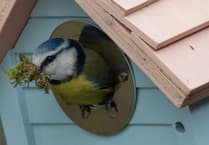
This circular walk has everything that is typical of the Mid Devon countryside: a varied mix of landscapes and habitats from the uninterrupted views of Dartmoor seen from the hilltop adjacent to Backs Barn (as was – very old map used) to fields, hedgerows – some old and large with abundant hips, haws and sloes in the autumn, the river Yeo – frequented by kingfishers, sand martins, trees and old green lanes.
The proposed building would erode the edges of this walk – still enjoyed by many people.
Other points I would like to make: more building in the proposed areas would increase the likelihood of flooding and more roads would increase pollution and noise. Do the planners even know these areas? Have they walked them? Do they care about our Natural heritage, green spaces, climate change?
Although I feel it would be good to combine the Upper and Lower Q.E. schools at the Upper School site – (No more school coaches struggling up and down Barnfield and Park Road) – I would see it as an opportunity to return the land at the Lower School to an open green space (including keeping the playing fields) – an area for tree planting and an educational space for ecological studies and activities.
Sandra Chalton
Crediton
Address Supplied
Comments
This article has no comments yet. Be the first to leave a comment.